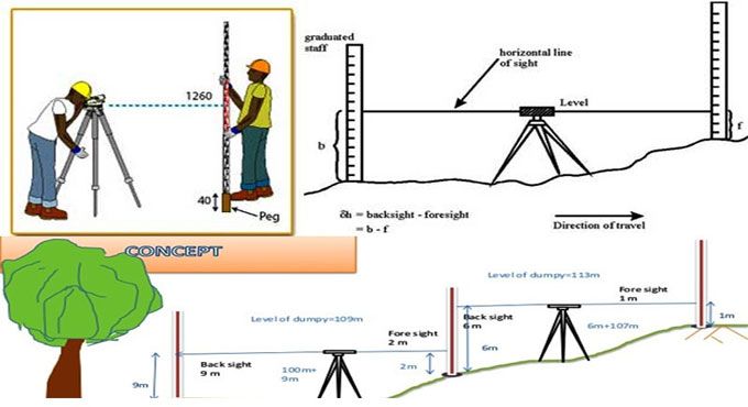
Levelling is the art of determining the relative elevations of different objects or points on the earth’s surface. This is done by taking measurements in the vertical plane. Hence, this branch of surveying deals with measurements in vertical planes. Levelling is the most widely used method of obtaining the elevations of ground points relative to a reference datum and is usually carried out as a separate procedure to those used in fixing planimetric position. The basic concept of leveling involves the measurement of vertical distance relative to a horizontal line of sight.

Hence it requires a graduated staff for the vertical measurements & an instrument that provides a horizontal line of sight.
Trigonometric or Indirect levelling is the process of levelling in which the elevations of points are computed from the vertical angles and horizontal distances measured in the field, just as the length of any side in any triangle can be computed from proper trigonometric relations. In a modified form called stadia levelling, commonly used in mapping, both the difference in elevation and the horizontal distance between the points are directly computed from the measured vertical angles and staff readings.
